

The Most Challenging Route on Mount Kilimanjaro
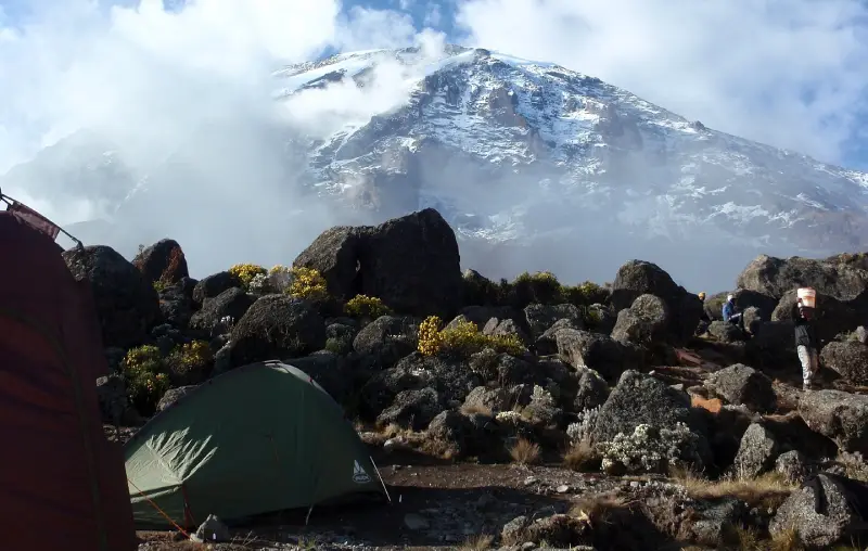
The Umbwe route has a well-deserved reputation for being the most challenging route on Mount Kilimanjaro. Due to the fast ascent to high altitude, this route does not provide the necessary stages for acclimatization. Together with the fact that the number of people on this trail is very low, the chances of success are also low. Umbwe is considered to be a difficult, taxing route - one that should only be attempted by strong hikers and experienced adventurers who are confident in their ability to acclimatize quickly to altitude. Approaching from the south, the Umbwe route is a short, steep, and direct climb. After reaching Barranco Camp, the trail turns east and traverses underneath Kilimanjaro's Southern Ice Field on a path known as the Southern Circuit before summiting from Barafu. Descent is made via the Mweka route.

Holiday Adventure Africa is happy to offer you the chance to get to the roof of Africa via the Umbwe route from 6 to 8-day tours. Please kindly find detailed programs and prices for each option in the following links, and feel free to take a look at Holiday Adventure Africa Gallery.
Below is a sample for a 6-day climb. Please note that the difference between the 6-day and 7-day climb is the additional acclimatization day at Barranco camp. The more you spend time acclimatization, the higher your chance of summiting Uhuru peak.
Holiday Adventure Africa Umbwe route Kilimanjaro Itinerary
Day 1: Umbwe Gate to Umbwe Cave Camp
After breakfast, you will be driven from Moshi town to the Machame gate, where registration formalities will be completed and where you will enjoy your first hot lunch. From the Machame gate, you will be transferred to the Umbwe Gate (1641m), passing through the lush villages greened with coffee and banana plantations. When you start hiking, the air is thick with moisture, and the path is usually muddy. The route initially follows a forestry track winding up through the natural rainforest. It then narrows and steepens to climb the ridge between the Lonzo and Umbwe rivers, with huge trees surrounding you. The path offers some spectacular views of deep gorges and even glimpses of Kilimanjaro towering above you in the distance. Your final point for the first day is Umbwe Cave Camp, surrounded by huge trees, where you will spend the first night in nature.
-
Elevation:
1614m to 2850m
-
Distance:
Approximately 10.3 km
-
Hiking Time:
5-6 Hours
-
Habitat:
Rainforest
-
Meals:
Lunch - Dinner
Day 2: Umbwe Cave Camp to Barranco Camp
Shortly after you leave Umbwe Cave Camp, the forest starts thinning and is replaced by rockier terrain, sparser undergrowth, and straggly, moss-covered trees. The path continues along a narrow but spectacular ridge. As you gain higher altitude, catch glimpses of Kilimanjaro rising majestically ahead of you with a stunning background of blue sky. The path later flattens as you approach Barranco Valley. From the Umbwe ridge, the route descends slightly to the Barranco camp. The camp is situated where you spend the second night right in the valley below the legendary Barranco Wall, which surely gives you a memorable sunset while your dinner is being prepared.
-
Elevation:
2850m to 3985m
-
Distance:
Approximately 6.3 km
-
Hiking Time:
6-7 hours
-
Meals:
Breakfast – Lunch – Dinner
Day 3: Barranco Camp to Karanga Camp
After spending a night at the great Barranco Wall, you will make your way passing this awesome-looking obstacle, which in the end, turns out to be easier than anticipated. Topping out just below the Heim Glacier, you will now appreciate just how beautiful Kilimanjaro really is. The route then heads down through the Karanga Valley over intervening ridges and valleys and then joins up with the Mweka route. This is the preferred route down from the summit, so remember it. The last water stop on the route is the Karanga Valley, as there is no water available at Barafu camp. But don't worry! Holiday Adventure Africa Porters will bring boiled, purified water for you during your whole journey! You will enjoy dinner and overnight at the Karanga camp.
-
Elevation:
3850m to 4040m
-
Distance:
Approximately 6 km
-
Hiking Time:
6- 7 hours
-
Habitat:
Moorland / Semi-desert
-
Meals:
Breakfast – Lunch – Dinner
Day 4: Karanga Camp to Barafu Camp
After breakfast, you will start your 4th day by turning left up the ridge, and the route ascends 640m toward Barafu Camp. Barafu is the Swahili word for "ice," and it is a bleak and inhospitable camping area to spend the night. Totally exposed to the ever-present gales, the tents are pitched on a narrow, stony, and dangerous ridge. Please make sure that you familiarize yourself with the terrain before dark to avoid any accidents. The holy summit is now a further 1214m higher, and you will commence with your final ascent attempt the same night. Prepare your equipment and thermal clothing for your summit attempt. This should include the replacement of your headlamp and camera batteries, and make sure you have a spare set available as well. To prevent freezing, it will be wise to carry your water in a thermal flask. Go to bed as early as possible and try to get some precious rest and sleep.
-
Elevation:
4040m to 4681m
-
Distance:
Approximately 3.4km
-
Hiking Time:
4-5 hours
-
Habitat:
Alpine Desert
-
Meals:
Breakfast – Lunch – Dinner
Day 5: Barafu Camp to Uhuru Peak Down to Mweka Camp
Around 11:30 pm, you will get up for some hot tea and biscuits before you shuffle off into the night. You will head in a north-westerly direction and ascend through heavy scree toward Stella Point on the crater rim. For most climbers, the unforgettable walk to Stella point is the most mentally and physically challenging on the route. At Stella Point (5739m), you will stop for a short rest and will be rewarded with the most magnificent sunrise you are ever likely to see. From Stella Point, you will normally encounter snow all the way on your 2-hour ascent to Uhuru Peak. The time you spend on the summit will depend on the weather and your conditions, but do not stop here for too long, as it will be perhaps more difficult to get down! After that, you will try to descend to Baranfu camp as soon as possible to treat yourself to a well-deserved hot lunch and collect all of your luggage before the final descent. You then head down to Mweka Camp (3090m), where the route is not difficult and will take you down the rock and scree path into the moorland and eventually into the rainforest. At Mweka Camp, you will surely enjoy one of the best sleep ever!
-
Elevation:
4681m to 5985m down to 3090m
-
Distance:
Approximately 4.5 Km Ascent and 10.8 Km Descent
-
Hiking Time:
7-8 hours to Uhuru Peak, 6-8 hours to Mweka Camp
-
Hiking Time:
Stone scree and ice-capped summit
-
Meals:
Breakfast – Lunch – Dinner
Day 6: Mweka Camp to Mweka Gate
After the last breakfast on the mountain, it will take 4 to 6 hours to take a scenic hike back to the Mweka gate. Some hikers experience knee problems that could make the descent longer than planned. So don't forget your walking poles! At Mweka gate, you will sign your name and details in a registration form. This is also where successful climbers receive their summit certificates. Those climbers who reached Stella Point (5739m) were issued green certificates, and those who reached Uhuru Peak (5895m) received gold certificates. Here you are strongly encouraged to give your Mountain Supporting Team appropriate tips after all of their hard effort to guide you to the top of Africa. From the Mweka Gate, you will be driven down into the Mweka village, where you will be served a delicious hot lunch!! After lunch, you drive to Moshi for a long overdue hot shower, dinner, and celebrations!!
-
Elevation:
3090m to 1641m
-
Distance:
Approximately 8.5 km
-
Hiking Time:
4-6 hours
-
Habitat:
Forest
-
Meals:
Breakfast - Lunch


