

Witness the Beauty of the North Route of Kilimanjaro
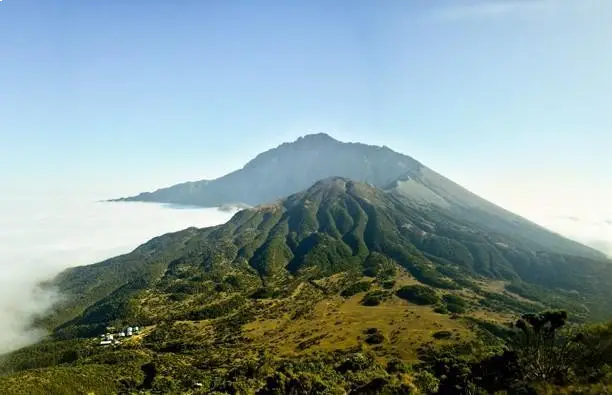
The Rongai route is the only route that approaches Kilimanjaro from the north, close to the Kenyan border. Though gaining popularity amongst climbers, this route still experiences low crowds. Rongai has a more gradual slope than the mountain's other routes. It is the preferred route for those looking for an alternative to the popular Marangu route, for those who would like a more remote hike, and for those who are climbing during the rainy season (the north side receives less precipitation). Rongai is a moderately difficult route and is highly recommended, especially for those with less backpacking experience.

Although the scenery is not as varied as the western routes, Rongai makes up for this by passing through true wilderness areas nearly the entire way. Descent is made via the Marangu route.
Holiday Adventure Africa is happy to offer you the chance to get to the roof of Africa via the Rongai route from 6 to 8-day tours. Please find detailed itineraries and prices of each option in the following links and Holiday Adventure Africa Gallery.
Itineary
Day 1: Nalemoru Gate to Simba Camp
This morning, we will drive to the village of Nalemoru for the starting point of the Rongai route. The first stage of the trek is through farmland and pine forests. You may have a chance to see the beautiful Colobus monkeys or, if you're lucky enough, elephants or buffalos en route. Our first camp will be the Simba Camp, located at the edge of the moorland zone at 2625m.
-
Elevation:
1990m to 2625m
-
Distance Covered:
8km / 5mi
-
Time Taken:
4 - 5 hours
-
Meals:
Lunch – Dinner
Day 2: Simba Camp to 2nd Cave Camp
The morning hike is a steady ascent up to the Second Cave Camp, located in the moorland zone with superb views of Kibo and the Eastern ice fields on the crater rim.
-
Elevation:
2625m to 3480m
-
Distance Covered:
5km / 3.1mi
-
Time Taken:
3 - 4 hours
-
Meals:
Breakfast – Lunch – Dinner
Day 3: 2nd Cave Camp to Kikelewa Camp
Leaving the pine forest behind, we walk through the moorland with a steady ascent. There are superb views of the Eastern ice fields on the crater rim of Kibo, the highest of the three volcanoes which form the mountain. We will leave the main trail and strike out across the moorland on a smaller path toward the jagged peaks of Mawenzi, the second of Kilimanjaro's volcanoes. We will set up camp today in the sheltered valley near Kikelewa caves at 3630m.
-
Elevation:
3480m to 3630m
-
Distance Covered:
5km / 3.1mi
-
Time taken:
3 - 4 hours
-
Meals:
Breakfast – Lunch – Dinner
Day 4: Kikelewa Camp to Mawenzi Hut
This morning, we have a short but steep ascent up grassy slopes, which is rewarded by a superb view of the Kenyan plains to the north. We leave vegetation behind shortly before reaching our next camp at Mawenzi Tarn Hut, directly below the towering cliffs of Mawenzi. This afternoon, you have a chance to rest or explore the surrounding area to aid acclimatization.
-
Elevation:
3630m to 4310m
-
Distance Covered:
8km / 5mi
-
Time Taken:
4 - 5 hours
-
Meals:
Breakfast – Lunch – Dinner
Day 5: Mawenzi Hut to Kibo Hut
We leave our campsite and cross the lunar desert of the 'saddle' between Mawenzi and Kibo. After a couple of hours of trekking, we reached this spectacular place, with the summit of Kilimanjaro in the background and our trail to the high camp stretched out before our eyes. Upon reaching our camp, the remainder of the day will be spent resting in preparation for the final ascent after a very early night!
-
Elevation:
4310m to 4700m
-
Distance:
8km / 5mi
-
Time Taken:
5 - 6 hours
-
Meals:
Breakfast – Lunch – Dinner
Day 6: Kibo Hut to Uhuru Peak Down to Horombo Hut
Today is "The Big Day" - the summit stage. You will begin your final ascent around midnight, which will be long and strenuous. Passing the Hans Meyer Cave at 5220m, the climb slowly but surely goes upwards. At sunrise, you will reach Gillman's Point (5681m) – the crater rim of Kilimanjaro – where the sun will slowly warm up the land. You will soon have forgotten the cold of the night, and after a further hike of 1 - 2 hours, you will reach Uhuru Peak at 5895m. On your return to Kibo Hut, a warm meal awaits you followed by a 1 - 2 hour break before returning to Horombo Hut.
-
Elevation:
4700m to 5895m down to 3700m
-
Distance Covered:
22km / 13.7mi
-
Time Taken:
12 – 15 hours
-
Meals:
Breakfast – Lunch – Dinner
Day 7: Horombo Hut to Marangu Gate, Back to Town
The last stage passes through the heath and moor zone to the Mandara Hut (2700m), where a warm lunch awaits you. Soon, you will once again pass the tropical rainforest, and after 6 hours of trekking, you will be back at the Kilimanjaro National Park Gate (1860m). After saying goodbye to your mountain guides, a short transfer takes you back to your hotel in Moshi. Once there, you can take a warm and relaxing shower and celebrate your success in reaching the summit of Kilimanjaro.
-
Elevation:
3700m To 1860m
-
Distance Covered:
20.8km / 12.9mi
-
Time Taken:
8 Hours
-
Meals:
Breakfast – Lunch


